Beauty of Seven Falls

Thursday, November 15, 2012

Picture Rocks Area Trails in the Tucson Mountains

Well, the long summer hiatus is over guys.  Back to the trails. 
 

This was actually our second hike of the season.  Our group was pretty good size - 12 strong.  We did a little over 5 miles of the Picture Rocks Area Trails on the eastern border of the north Tucson Mountain foothills.  The trails - Ironwood Forest, Brittlebush, Thunderbird, Canyon Cactus, Picture Rocks Wash, Prophecy Wash, Cam-Boh Trail Gila Monster and some other trails connect in a 10.7 mile loop. We did several of the trails - Picture Rocks Wash, Canyon Cactus, Gila Monster Trail, and maybe a part of another trail. 

Ernie leading the way with Connie a close 2nd
 
We were just following the amazing rocks with petroglyphs chipped into the surface.  Some are thought to be as old as 1,000 or more years and were created by the ancient Hohokam natives that lived in this area.  No one knows just what they mean.  The images of the sun, snakes, lizards, game animals and humans may have had religious or ceremonial significance.  We found many of the carvings quite by accident.  The group would stop to take a drink or a snack and there in front of us were markings.

Walt pulling cactus spines from his hand
 

The weather was perfect and it was a pretty moderate hike.  Some of us (myself included) found the loose gravel and sand in the washes pretty difficult to manuever.


 We even had one member of the group that slipped on some of the loose footing and fell right into a prickly pear cactus.  He was okay, but poor Walt was pulling the cactus spines out his hand for the rest of the hike.


 I actually had an encounter with a jumping cholla that attached itself to my boot and rode along for a couple of miles.  Didn't pierce that hard rubber sole though....

It's all fun and games until a jumping cholla attacks your foot.
We came across a few lone hikers, but I don't get the solitary bit.  We have such a good time with each other on the trails - talking, laughing, catching up with family news, and oh yes - eating lunch!

The 3 pictures below shows some of the group having lunch.  We all tried to find a shady spot and it ended up looking like a seek and find puzzle.  Can you find George, Bonnie, Walt, Jim and Justin?

Walt and JoAnn
George and Bonnie

Barb, Jim and Justin
 MMMMM

 LUNCH!
 
AHHHH
 
 REST!


Oh My Gosh!  I almost forgot!  Not only did we see plenty of cacti, petroglyphs, and a little wildlife, we also came upon an old - AND I MEAN OLD - Bonnie and Clyde type car in the wash.  It was very cool and totally riddled with bullet holes.  We couldn't resist a few pictures of that. 

Closer shot of car to show holes

That's me holding Walt at bay with my hiking pole.  lol
 
Well sports fans, that's all til next week.  
Happy trails to you!
 

Thursday, May 17, 2012

Chiricahua National Monument in the Coronado National Forest


Well sports fans - talk about saving the best til last - this was it!  Our hiking outings ended with a bang with us hiking several trails of the Chiricahua National Monument. 

Our group - consisting of Stan, Barbara, Jorge, Gina, Ernie and myself - starting out at 6:00 a.m. (I admit to being half asleep) with Stan behind the wheel.  It would be approximately a two hour trip from Tucson to the visitor's center.

As with most of the hikes I have been fortunate to be a part of, the weather was beautiful.  Blue skies and warm temperatures were the predictions for the day.  We were hoping to finish our hiking before the late afternoon heat.


From beginning to end the hike that had been hyped as magnificent by several fellow hikers during the winter and spring lived up to all the hype.  The towering rock formations were awe inspiring (although we didn't hike to Inspiration Point).  The rock pinnacles were called "standing up rocks" by the Chiricahua Apache who lived in the forests and lands surrounding the Chiricahua Mountains for hundreds of years.


We took the shuttle at the visitor's center in Bonita Canyon which took us up to the trail head.  The shuttle driver told us a lot of the history of the Monument, including how it was created.  27 million years ago eruptions from the Turkey Creek Caldera Volcano, which was one thousand times greater than the 1980 eruption of Mount St. Helens, laid down two thousand feet of highly silicious ash and pumice. This mixture fused into a rock called rhyolitic tuff and eventually eroded into the spires and fascinating rock formations of today. In 1924 President Calvin Coolidge set aside this wonderland to be preserved as the Chiricahua National Monument.

Cochise Head (see the nose pointing to the sky?)
The driver also talked about how it became the stronghold for the Apache leaders Cochise and Geronimo and their people.  If you are a history buff like myself, you can let your imagination run wild!  I had a tendency to blend history, John Wayne movies, and documentaries into one.  I could see Native Americans on horseback on ridges, or women and children in camps grinding corn.....until the food ran out and they eventually surrendered to Union soldiers in 1886.
Mushroom Rock
Big Balanced Rock


We were dropped off at Massai Point and began our descent via several connecting trails and loops.  Some of the trails were named after some of the famous rock formations.  We traveled on Mushroom Rock Trail and Big Balanced Rock Trail.  The elevation at the trailhead at Massai Point was 6,870 and we did a mostly gradual decline to 5,400 ft. at the visitor's center.  We made frequent stops along the trail for rest and water.  It is noticeably cooler in the Chiricahuas than in Tucson because of the elevation, but still very warm for hiking.  This was a truly enjoyable hike in almost every way.  The one very sad thing that was so striking was the devastation left behind from the wildfires in 2011. 

The Horseshoe 2 Fire began on May 8, 2011 in the Horseshoe Canyon area of the Chiricahua Mountains and burned nearly 223,000 acres, destroying 23 homes or buildings.  
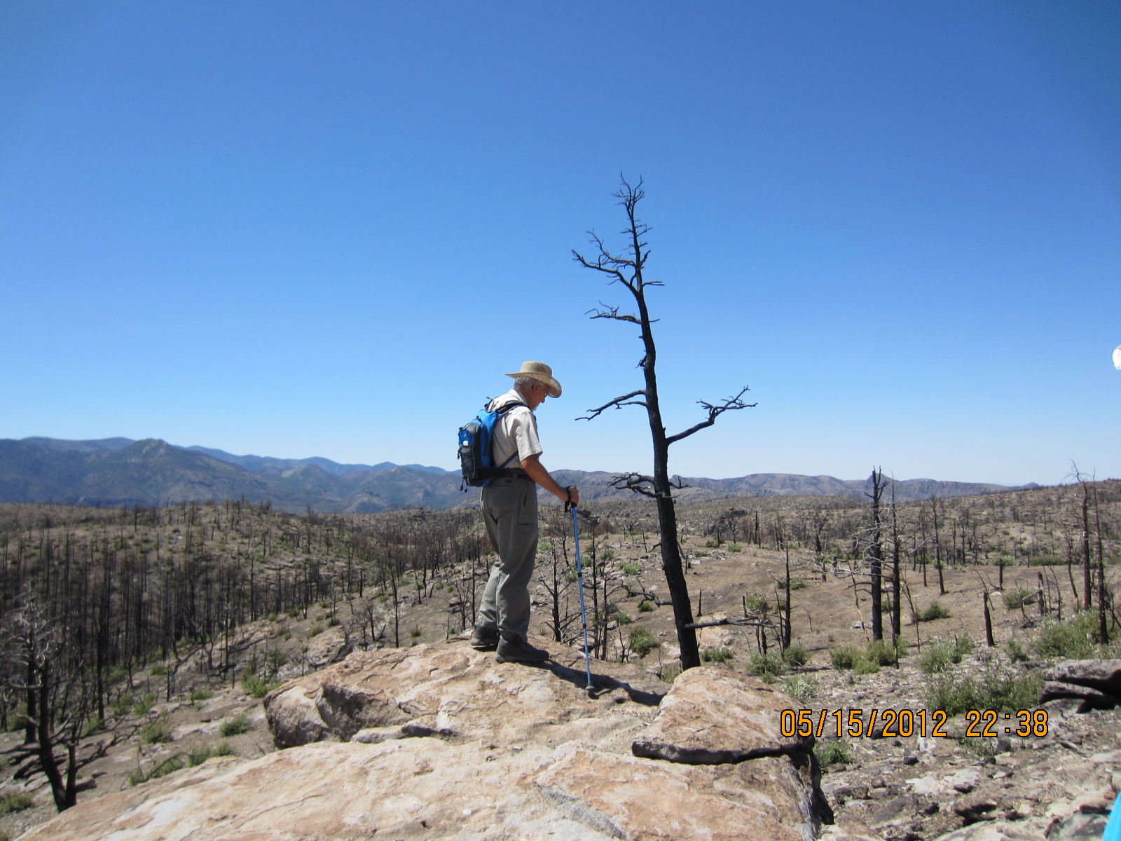
Devastation the 2011 wildfires left behind
Investigators were unable to access the area immediately and unable to pinpoint the fire’s ignition point because of subsequent fire-fighting activities.It was heartbreaking to walk through burned out areas that were once plush forests. We agreed that we could have endured the pain a little easier if the fires had been from natural causes such as lightning strikes, but knowing they were of human origin made it harder.

I can only imagine how beautiful this tree was before......


Jorge made the observation of how you can find beauty everywhere if you look.  He then found this burned out tree from the fire and I realized what he meant.  This tree - even burned out and barren, was a thing of beauty.

Sadness at loss of vegetation and wildlife


We hiked a total of approximately 8 miles.  We started at Massai Point and traveled the Mushroom Rock Trail, Big Balanced Rock Trail, Heart of Rocks Loop, Sarah Deming Trail and finally the Lower Rhyolite Canyon Trail back to the visitor center.  We had a little welcoming committee waiting when we got back, a group of 3 white tail deer feeding near a campsite.  As our group approached they continued to feed on new vegetation, showing no fear of us.  Ahhh nature, you got to love it! 

White-tailed fawn having lunch

More random pics from an excellent hike!!!


Camel's Head
Formations at the Heart of Rocks Loop


Kissing Rock
Punch & Judy


BREAK TIME YAY!!!

Happiness is a PB&J sandwich

Jorge unloading his gear


Ernie always has the best sandwiches!


On the trail again.....


These look like sentries guarding the monument


I named this one Sly and the Family of Stone


Happy Trails to you, until we meet again!

Sunday, April 29, 2012

Green Mountain Trail, Santa Catalina Mountains in the Coronado National Forest

Our small group of 4 – Stan, Gina, Ernie and me – started out at 7:30 a.m. and made our way through town to the Catalina Highway.  So extraordinary that within an hour or two you can leave town and be out among the ponderosa pine, Douglas fir, and Arizona cypress.  This is a nice short one-way hike which can be done in any season, although spring and fall are the best times to do it. The trail goes through different types of forest, and there are very nice views at the upper end. There are also a number of short side trails that you can take.
The Green Mountain Trail starts at over 7,000 feet and winds down about 1,000 to the General Hitchcock campground, the 3.9 mile trail (one way) offers excellent views across the San Pedro Valley.  This hike is a one-way hike where you usually would do a car shuttle to get back to your starting point. Keep in mind… our hikes are becoming more and more abbreviated and modified because of the weather.  We have already had temps of 100 degrees so we have had to alter the normal trails to suit our very selfish need to hike as long as we possibly can.  That being said, we started our hike in reverse, starting at the General Hitchcock campground and climbing up. 
We started out with temperatures a gorgeous 67degrees, knowing that it wouldn’t be long before they would begin to climb.  The views were absolutely wonderful.  There were hillsides covered with rock formations and thin scrubby forest of pine, oak, manzanita, chaparral and juniper. From some points along the trail we could see Bear Canyon and see Thimble Peak framed at the far end of the canyon. The smell of the pines was amazing, but even more amazing was the sound of the wind blowing through them. 
The group was small and quiet for the most part so we could really enjoy the sounds of nature.  I tried to sing at one point – as I am known to do on hikes – but my song was very short-lived as I was having trouble with the altitude. 
 

We had to make frequent stops because of the altitude.  It wasn’t hot, so we didn’t have to make stops for drinks….it was only because we would become short of breath after the steep climbs.  I say “we” but maybe I should speak for myself.  I am the novice hiker and I am not ashamed to admit when I am out of breath.  The others seemed to be doing fine, but it got harder and harder for me to face another steep incline.  Finally, at about 90 minutes or so in, I felt I was really pushing myself and decided it was time for me to stop.  I offered to stay at this point while the others went ahead to the saddle – our turnaround point (which was actually in view) but the others decided we should stay together as a group.  You have no idea how happy I was at their decision, because I am a big chicken when it comes to lions, tigers, and bears! 
 I don't remember what Stan was teaching us on this one :-(
We took about 20 to 30 minutes to have our lunch before starting back down.  It seemed I picked a really nice spot to give out.  There were some incredible rock formations all around us.  One even looked sort of like a totem pole. 
Thimble Peak
After our light lunch, which did wonders to renew my strength, we started our hike back down to the campground.  Going down was much easier (as usual) than the climb up. We had a wonderful hike, no misadventures, no rattlers, bears, mountain lions or anything.  We were just enjoying each other’s stories and nature’s beauty…..until we reached the end of the trail – the campground – where we were met with a camper in the all-together walking around his campsite.  We weren’t prepared for this much nature, so agreed it was time to call it a day.
Modesty prevents me from posting pictures of the camper....
Oh yes, I would like to take this time to also mention that I didn’t mention any of our group’s unmentionables or wardrobe malfunctions.  lol

Thursday, April 5, 2012

Sweetwater Trail in Saguaro National Park


Me and cactus flower
Well, I’ve been off the trail for several weeks because of personal obligations.  Translation: I had family visiting for a week, I had jury duty the following week, and the third week I was a no account slacker.  That being said, our hikes are dwindling down to a precious few now.  The main group disbanded last week because the temperatures reached way up in the 80s and several people showed signs of heat exhaustion.  We are now operating with a much smaller group and we are abbreviating the length and difficulty of the hikes because of the heat. 


We have decided to gather an hour earlier figuring we can get started earlier and end the hikes before the heat gets dangerous.Whereas our normal hiking group ran between 12 and 18 members per hike, we only had four in our abbreviated group Wednesday.


We left the community center bright and early at 7:30 a.m., which means I was up at 6:00 a.m. so I could walk my dog before starting out. Needless to say….I was not bright eyed or bushy tailed in the least!   

BrickleBush

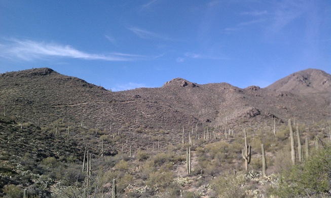
This week we hiked the Sweetwater Trail in Saguaro National Park in the Tucson Mountains.  We were aiming for the 3.4 mile mark as our turnaround spot.  This point is called Sweetwater Saddle and is the point where the trails from the west side of the park meet the Sweetwater Trail and from here all the trails share the same route to Wasson Peak, the highest point in the Tucson Mountains.   
Jumping Cholla Cactus


We had agreed at onset to hike 1 ½ hours one way, stop for a brief lunch and head back.  We had plenty of breaks to drink water and take pictures.  The scenery was absolutely breathtaking! 

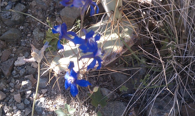
The most notable thing of this hike was the flowers.   The desert was definitely in bloom and we had a wonderful time just trying to identify all of the flowers, cactus, plants and birds along the trail.  There were blossoms of every size and color.   We even took picture of this one cactus flower that looked as if it were coming out of a rock.   
Jorge snapping pics of flowers


This was a most enjoyable hike.  We didn’t quite make it to Sweetwater Saddle before we stopped and turned around, but that’s okay.   We were close enough and we didn’t have any problems – heat or otherwise. 


Me, Connie, Stan and SAGUARO

Hike Statistics (We only did 3 hours, with a break in the middle so we didn’t make the total mileage )

Distance Round Trip 7.36 mile
Trailhead Elevation 2,543 feet
Elevation Gain 412 feet
Accumulated Gain 536 feet
Average Time Round Trip 3.5 hours