Beauty of Seven Falls

Thursday, January 24, 2013

Return to Bear Canyon Trail in Beautiful Sabino Canyon


Beautiful view of Seven Falls
Our robust group of 9 met at our regular time of 8:30 a.m. and headed out to Sabino Canyon in the Coronado National Forest.  Most of our group has been to Sabino Canyon many times, and I was psyched to see how far I had progressed since last year when I hiked this for the first time.

This hike is listed as moderate on most of the trail guides and to a “Novice Hiker” that means the degree of difficulty is pretty high.  Sabino Canyon is located in the foothills of the Santa Catalina Mountains. The Bear Canyon trail is approximately 9 miles round trip. We cut about 4 miles off this total by taking the shuttle from the welcome center up to the actual trailhead. When I hiked this trail the first time, I was actually crawling up the rocks by the time we made it up to the Seven Falls.  

JoAnn leading us over one of the crossings

Everyone was very surefooted this hike
Gordy bringing up the rear

This is not an easy hike by any stretch of the imagination.  The trail crisscrosses over Sabino Creek and because of the melting snow up in the higher elevation of the Santa Catalina Mountains all of the crossings had plenty of water streaming through.  The first thing I would like to mention is that I did not slip off any stepping stones into the stream this year.  YAY!  I was seven for seven.  There are seven crossings going up and the same seven coming back down.

The canyon was even more beautiful than I remembered.  I guess on my first hike, I tried to keep my eyes on my feet to make sure I didn’t trip and fall.  It is one of the most beautiful hiking areas in southern Arizona. Not only do you see the ever present saguaro, cholla, and prickly pear cactus, but the streams flowing through and across the basin.  There are just breathtaking views.  The few photos I insert in this blog does not come close to capturing the real beauty.

Breathtaking view of the walls of the canyon from the trail
A little history of Sabino Canyon:  Some of the earliest human occupants of Sabino Canyon were the Native American Hohokam people.  There is evidence in pieces of pottery, or shards, and pit house foundations that the Hohokam people lived in the canyon between 300 and about 1400 AD. With the Gadsden Purchase in 1854, Sabino Canyon became part of the United States.  The Gadsden Purchase, or Treaty, was an agreement between the United States and Mexico, finalized in 1854, in which the United States agreed to pay Mexico $10 million for a 29,670 square mile portion of Mexico that later became part of Arizona and New Mexico.

One of many fallen boulders
In Tucson's early days, people took picnics to Sabino Canyon. In 1887, there was a big earthquake in Mexico, 150 miles away from Sabino Canyon. Many of the huge boulders you see in the canyon fell from the canyon walls or were moved in that quake. In 1890, the Forest Preservation Act was passed by the United States Congress and in 1905 when the Forest Service was created, Sabino Canyon came under its supervision.


One of the things that really stood out on this hike was the lack of blue skies.  If you notice pictures of other hikes we've been on, the sun is always high in the sky and the sky is usually so blue it looks artificial.  The lack of sunshine didn't dampen our spirits or diminish the beauty of the canyon.  It was about 80 degrees when we finished so it’s probably a good thing it was partially cloudy. 


It took us about an hour and a half to make it from the trailhead up to the falls.  That is where we took a nice break and had our lunch.  The pictures below show some the views we enjoyed while resting, eating and chatting.


Connie & LeNeta


Ernie & Gordy


JoAnn and Jim deciding the next hike

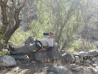
Connie catching a cat nap.

After a brief lunch we headed back down the trail.  It always seems much easier going down.  It was a wonderful hike - as usual.  Some of us  enjoyed picking out mountains we could see as we waited for the shuttle for the return trip to the parking lot.  Others used this time to catch up on some much needed rest and relaxation....


I wanted to take this boulder with me....
See you on the trails!

Friday, January 18, 2013

Catalina State Park


I have to give a shout out to our hike on Wednesday, January 9th.  I was unable to do the blog that week, but we had an awesome time at the Catalina State Park.  We hiked the Canyon loop Trail combined with the Romero Ruins Interpretive Trail.  The total is approximately three miles with 100 ft. elevation gain.  Here are a few pictures of the hike....


The most amazing saguaro I have seen to date!  

It actually had a prickly pear cactus growing between it's arms!


Sometimes a picture is worth a thousand words.  

See you on the trails!


Saguaro National Park West

Beautiful view of mist in the mountains 
Our hike this week took us to beautiful Saguaro National Park West in the Tucson Mountains.  Ten enthusiastic, overly bundled hikers (our temperatures here in Tucson had been below normal for 4 days and we had no idea what to expect up on the trails) met at the community center and started out at 8:30.  The weather was a little chilly, but beautiful Arizona sun did not let us down.  The morning was gorgeous. 

We got off to what we thought was a good start when JoAnn realized she had not placed her park pass on her windshield for the park rangers.  Not a huge problem because we had good old Jim to run - and I do mean run - back to the parking lot to put it in place. 
Run Jim, Run
We began our morning at the King Canyon Trailhead heading for the Gould Mine.  The Gould Mine was one of four mines of some consequence in the Tucson Mountains: Old Yuma, Gila Monster, Mile Wide, and Gould mines.  Sometime around 1906 S.H. Gould filed on nineteen claims for the Gould Copper Mining Company. As was the case with other mining companies, Gould encountered financial problems with the onset of the 1907 depression, but he succeeded in obtaining operating funds by taking a mortgage with the Pioneer Smelting Company from nearby Sasco. A thirty-five foot wide vein of copper was found at the 100 foot level. At the 200 foot level that vein broadened to a width of sixty feet. Unfortunately, an assay reported only three to four percent copper content in each ton of ore. Financial difficulty beset the Gould Company by the end of 1908 and it managed to survive only for a few more years by shipping excavated ore which had been stockpiled at the mine. It probably ceased operations sometime in 1911. In early 1915 the company was forced into bankruptcy and its claims were sold at a sheriff's auction. They were purchased by Douglas Gary of Tombstone who made no immediate attempt to operate the mine. For all the effort and investment only 45,000 pounds of copper with a value of $9,000 had been taken from the mine.

Copper mine desperadoes - LaNeta, Connie, Gina & me
We were able to see what was left of some of the buildings used for storage and shelter.  

JoAnn & Jim surveying the mine entrance


So how much barbed wire is needed?


There were barbed wire fences surrounding dangerous areas, such as the actual mine entrance, but of course that was meant for everyone except our adventurous Jim who spotted ringtail raccoons down in the shaft.

It took quite a hike to get to the mine and I was wondering if the men had to hike up to the mine every day or if they camped at the mine.  I found one picture online which showed the mining camp and it seemed to be at the base, not near the mine. 

Oh well, on with the hike….
Hi Ho Hi Ho it's on the trail we go....
I sometimes get caught up in the historic significance of the area, and fail to mention the beauty of what we see as we are hiking through the park.  The saguaro cactus that sometimes tower above us so high I can’t even figure out how to get the whole thing in the photos.  My good friend George told me last week, that I need a bigger camera.  L  Along trail we saw many different types of cactus, and we noticed a family of javelina on a lower trail from us.  Thank goodness, they were also downwind. 

Gordy measuring up to a saguaro - he lost
We proceeded from the mine past the Mam-A-Gah picnic area to the Sendero Esperanza Trail and from there to the Hugh Norris Trail.  The maps our leader JoAnn gets from the National Park Service are usually pretty accurate as far as the mileage of the trails and the elevation gain on each hike, but we had varying opinions on the distance of this one.  We all felt the total hike was more like 5 ½ or 6 miles rather than the 4+ miles the map was telling us.  Several of the group actually stayed behind when we stopped to take water and rest a little.  Being the novice hiker, I always push myself to keep up, so I made it to the saddle we were aiming for as a turn-around point.  I tell you, I was very glad that the trip back would be mainly downhill though.  OUCH!  My legs…. Anyway, enough with the whining! What are we hikers or cry-babies?  We made it to the saddle, and then doubled back, picked up the couple of people that had waited at the bottom, and trekked back to the Mam-A-Gah picnic area for MY favorite part of the hike….lunch.   
If you look real closely...saguaro are the supports 
After lunch, JoAnn located a shortcut that took us past a huge wash that probably looks more like a lake during monsoon season.  We didn't go into the wash, but those in the group that had been on this particular hike previously mentioned that there are petroglyphs on rocks along the wash.  It is just amazing that when you least expected - a petroglyph pops up.  Kind of like when my kids were young and their friends always seemed to show up right at dinner time.... Well, this hike was fantastic.  Wonderful weather, no mishaps, a lot of history and great fellowship.  

We retraced our steps past Gould Mine and took the loop trail back to the parking lot.  The total mileage again in question.  Boy, that hot tub is going to look good this evening.
Judy and Barb doing a few wardrobe adjustments?

See you on the trails!


Thursday, December 13, 2012

Garwood Dam Loop

Miles and miles of saguaro cactus
Our excursion this week took our merry group to the Saguaro National Park East in the Rincon Mountains.  Saguaro National Monument was created on March 1, 1933 by President Herbert Hoover.  On October 14, 1994, Congress elevated Saguaro to National Park status.

If you want to see cacti of every size, shape and age – this is the hike for you.  We saw thousands upon thousands of saguaro, prickly pear, barrel, and yes, even the dreaded jumping cholla cacti. 

One endangered animal, the Lesser Long-nosed Bat, lives in the park part of the year during its migration, together with one threatened species, the Mexican Spotted Owl. 


Safe distances from cactus.  lol
We started at the Broadway Trailhead and traveled several trails that made up the Garwood Dam Loop.  Many of the trails seem to intersect, more than once and can be very confusing to a novice hiker such as myself.  This is definitely one hike I would never attempt alone.  Thank goodness for our leader JoAnn and her ever-ready map.  She was always comparing her map to the markers along the trails and kept us on the straight and narrow.  The phrase straight and narrow is not being bandied about lightly.  Most of the trail was extremely narrow and was very rutted because of the horses that are ridden through the area.  We really got a workout because of the loose sand and gravel underfoot.  
Mountain views
Anyway, the day was beautiful; the blue skies and mountain views were breathtaking.  I am sure my photos never do the justice to the hikes.  I always try to imagine myself back in time, when Native Americans, or cowboys, or miners frequented the area.  When someone mentioned gold mining my imagination ran wild (as usual). 
Our group of 9 hikers made very good time considering the loose footing being so challenging.  We met several other groups along the way and got a chance to even chat with some volunteer rangers on horseback.  I realized that since I joined the group last winter,  this was the first time I had the pleasure to actually see rangers – volunteer or otherwise. 
I named the horse on the right below Sweetface, after the horse in the John Wayne movie The Searchers. I know, I know it was filmed in Monument Valley in the Chiricahuas, but it's what came to me when I saw her.  Doesn't she have a sweet face?

We made it to the Garwood Dam in just about 2 hours from the trailhead.  We rested and had our lunch (always one of my favorite times) at the dam.  This is where the history buff in me took over.  The area is dotted natural tanks that fill with water at different times of the year, but I still wasn’t aware of the history of the area we were hiking…but I was going to find out. 
Gordy at the dam
A little history of the area:
The Dam provided a steady supply of water for Nelson Garwood and his ranch in the 1950's before the area was part of the National Park system.  One of the trails used was named for natural tanks in the area – Wild Horse Trail.  We also traveled the Carrillo Trail so I did a little research on this name and discovered quite a bit of additional interesting history. 
In 1868, Don Emilio Carrillo built his Buena Vista Ranch.  He would later change the name to La Cebadilla, after the wild barley growing along the ranch’s creek. Carrillo had been living in the Tucson area since the age of 12, and, with some hard work, he built his ranch into a successful cattle operation.  Carrillo and other ranchers ran so many cattle in the foothills of the Rincons that vegetation was destroyed for generations to come. Lime kilns, operating in the 1880s, also seriously deforested the area. The remains of these kilns can be seen along the Cactus forest Trail.  We didn’t see any this trip, but I will be going back to the area to look for several of the things I now know about.  The kilns, the natural tanks, the airstrip used by the Garwood family, and the little room at the base of the dam that was used to store tools.
As with most history - there is good and bad.  In 1904, bandits seeking to cash in on some of Carrillo’s wealth ransacked the ranch in search of gold that they believed was buried on the property. The robbers hanged Carrillo by the neck from the rafters and tortured him—almost to death. Carrillo lasted another few years before passing away from complications from the attack.  Carrillo’s ranch changed hands several times eventually coming to be named the Tanque Verde Guest Ranch and is family owned and operated today and you can hang out by those deadly rafters in the ranch’s present-day card room.
The bits of history that I glean from the internet about the areas that we hike is what makes these weekly outings much more than just a hike in the desert for me.  We are walking trails where ranchers and miners eked out a living and maybe even a few hardened, desperate cowboy and bandito criminals hid out from the lawmen.  Take my word for it, not only does our hiking get my heart rate up, and my muscles stretched out, but it also captivates my imagination. 
Jim and Gordy checking out one of the natural tanks
As far as scenic views on our hikes, I would have to say this one doesn’t rate as highly as some of the others, but there is so much more to see – if you open your mind’s eye – besides cacti and sand and Arizona blue skies. 
We took a different trail on the trip back to the trailhead and it only took us about 1 ½ hours to return to the parking lot.  Total mileage for this hike was somewhere between 6 ½ to 7 miles.
One of the many saguaro along the trail
See you on the trails!

Thursday, December 6, 2012

Wild Burro Canyon in the Tortolita Mountains


Beautiful, ancient tree by the side of the trail
Our hike this week has to have been one of the most exciting so far.  Our group of 10 hikers met at the Community Center at 8:30 a.m. and once again we had beautiful blue skies and moderate temperatures .  Our destination was Dove Mountain, in Marana. Dove Mountain is a part of the Tortolita Mountain range boasting some 29 miles of trails, which includes classic Sonoran Desert terrain, rugged ridges, diverse wildlife, historic ruins and signs of prehistoric inhabitants.
 
We started at the Ritz Carlton Trailhead, and would be hiking in the Wild Burro Canyon.  And yes, this is the same Ritz Carlson which is playground for rich and famous pro golfers.  Each February, the top 64 players in the world compete on the Jack Nicklaus Signature golf course at The Ritz-Carlton Golf Club, Dove Mountain.  
Getting started
 
We hiked the Picture Rocks area several weeks ago, but this area of the Tortolitas also has petroglyphs, or rock carvings, the work of Ancient Indians, known today as the Hohokam.  Their geometric designs and figures of animals and people onto rock surfaces endure today, but we didn’t find any on this hike.
Wikipedia picture
By all accounts this was a fantastic hike.  We were able to locate a few crested Saguaro cacti.  These are called crested because of a relatively rare condition of abnormal growth in which the growing tip becomes elongated vertically to the direction of growth, thus producing flattened, ribbon-like, crested, or elaborately contorted top.  I have included a picture of one so you get an idea of what they look like. 
We were able to identify tracks of jack rabbits, and possibly bobcats or coyotes.  Your imagination can really run wild in the desert…
After completing the Lower Javelina Loop, we stopped for a break at before heading back to the Wild Burro Trail and enjoyed climbing around and trough the ruins of a line shack.  A line shack was a small cabin built on the open range where cowboys could take shelter while tending cattle or other duties associated with working on a large ranch.  

Well, needless to say, everything was joy–joy, love-love, happiness- happiness, etc., etc., until we started back to the trail....
 
Calamity Me?
Lovebirds in an empty nest? LaNeta & Gordy


Yep, it was all fun and games until a jumping cholla cactus decided to join us, and I do mean JOIN us.  One decided to piggyback a ride with our group ON THE PALM OF MY HAND!!! 


This was possibly the worse continuous pain I have felt since getting a rose tattoo on my back in 2008.  It radiated pain from my palm, up my arm, and to every nerve ending I wasn’t using at that particular moment.  Horrid!  Thank God for level headed hiking members.  LaNeta had lovely, pink jeweled piece of medical equipment (her description) a utility knife with a pliers attachment and Jim took total control of the situation. 


With a cool head and steady hand (even with me pounding on his shoulder every time he yanked one of the spines free) he soon had me free of the offending hitchhiker.  JoAnn pulled out the bactine and with several pats on the back, and kisses to make it all better from fellow hikers, we were on our way.  I kept my hands directly in front of me for the rest of the trek down Wild Burro Trail to the trailhead. 
This was a pretty moderate hike, with the round trip probably a little over five miles with 150 feet elevation gain.  Not-withstanding the little hitch in our get-along with the cholla toward the end of the hike...a good time was had by all. 
  
Our protectors on the trail for this hike: George, Gordy, and Jim


Of course, there was a time or two they let their guard down...


Jim relaxing along the way
 
George taking five


JoAnn, our fearless leader


Until the next time....see you on the trails!