Well sports fans - talk about saving the best til last - this was it! Our hiking outings ended with a bang with us hiking several trails of the Chiricahua National Monument.
 Our group - consisting of Stan, Barbara, Jorge, Gina, Ernie and myself - starting out at 6:00 a.m. (I admit to being half asleep) with Stan behind the wheel. It would be approximately a two hour trip from Tucson to the visitor's center.
As with most of the hikes I have been fortunate to be a part of, the weather was beautiful. Blue skies and warm temperatures were the predictions for the day. We were hoping to finish our hiking before the late afternoon heat.
Our group - consisting of Stan, Barbara, Jorge, Gina, Ernie and myself - starting out at 6:00 a.m. (I admit to being half asleep) with Stan behind the wheel. It would be approximately a two hour trip from Tucson to the visitor's center.
As with most of the hikes I have been fortunate to be a part of, the weather was beautiful. Blue skies and warm temperatures were the predictions for the day. We were hoping to finish our hiking before the late afternoon heat.
From beginning to end the hike that had been hyped as magnificent by several fellow hikers during the winter and spring lived up to all the hype. The towering rock formations were awe inspiring (although we didn't hike to Inspiration Point). The rock pinnacles were called "standing up rocks" by the Chiricahua Apache who lived in the forests and lands surrounding the Chiricahua Mountains for hundreds of years.

We took the shuttle at the visitor's center in Bonita Canyon which took us up to the trail head. The shuttle driver told us a lot of the history of the Monument, including how it was created. 27 million years ago eruptions from the Turkey Creek Caldera Volcano, which was one thousand times greater than the 1980 eruption of Mount St. Helens, laid down two thousand feet of highly silicious ash and pumice. This mixture fused into a rock called rhyolitic tuff and eventually eroded into the spires and fascinating rock formations of today. In 1924 President Calvin Coolidge set aside this wonderland to be preserved as the Chiricahua National Monument.
 |
| Cochise Head (see the nose pointing to the sky?) |
The driver also talked about how it became the stronghold for the Apache leaders Cochise and Geronimo and their people. If you are a history buff like myself, you can let your imagination run wild! I had a tendency to blend history, John Wayne movies, and documentaries into one. I could see Native Americans on horseback on ridges, or women and children in camps grinding corn.....until the food ran out and they eventually surrendered to Union soldiers in 1886.
 |
| Mushroom Rock |
 |
| Big Balanced Rock |
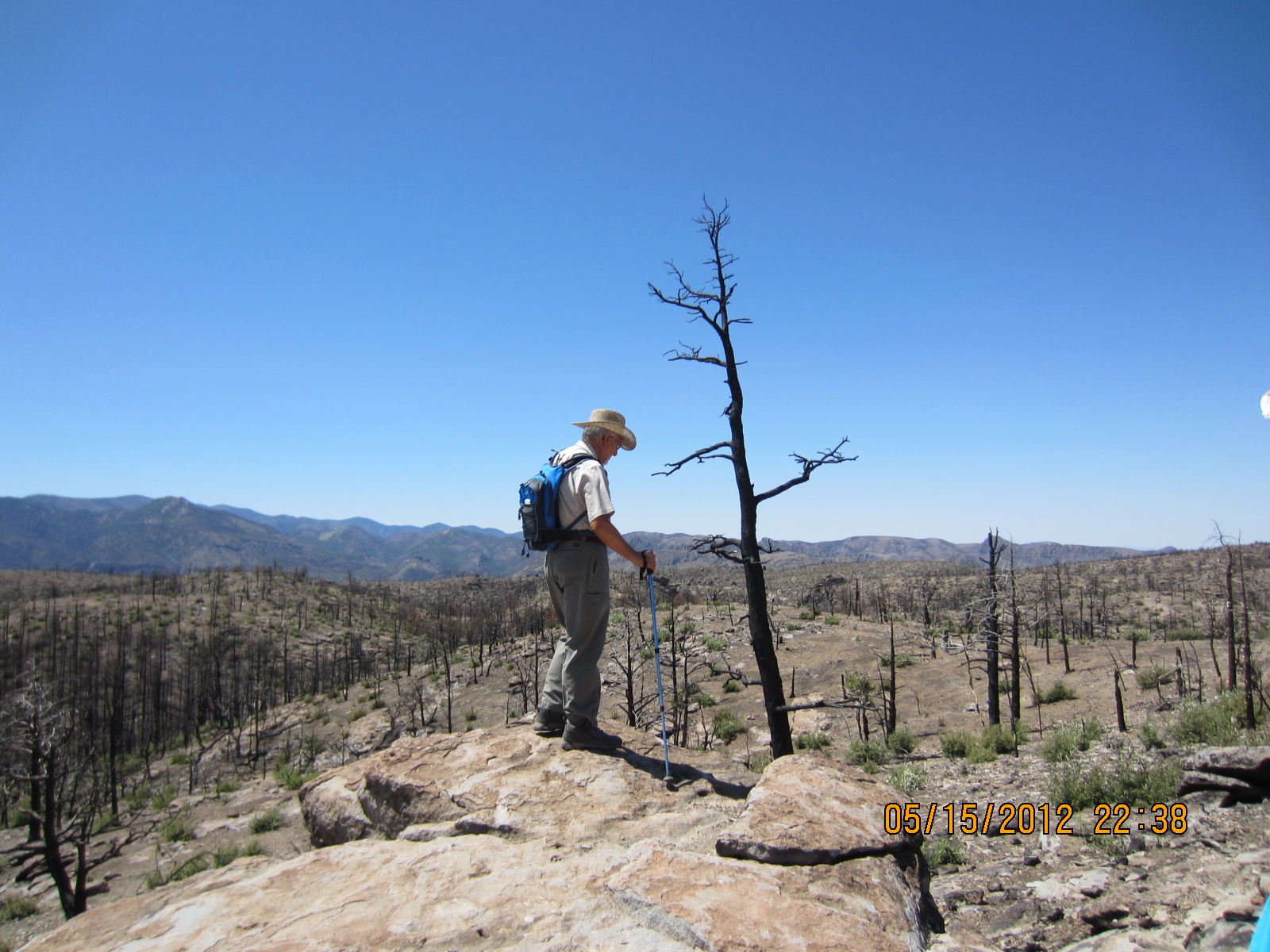
We were dropped off at Massai Point and began our descent via several connecting trails and loops. Some of the trails were named after some of the famous rock formations. We traveled on Mushroom Rock Trail and Big Balanced Rock Trail. The elevation at the trailhead at Massai Point was 6,870 and we did a mostly gradual decline to 5,400 ft. at the visitor's center. We made frequent stops along the trail for rest and water. It is noticeably cooler in the Chiricahuas than in Tucson because of the elevation, but still very warm for hiking. This was a truly enjoyable hike in almost every way. The one very sad thing that was so striking was the devastation left behind from the wildfires in 2011.
The Horseshoe 2 Fire began on May 8, 2011 in the Horseshoe Canyon area of the Chiricahua Mountains and burned nearly 223,000 acres, destroying 23 homes or buildings.
 |
| Devastation the 2011 wildfires left behind |
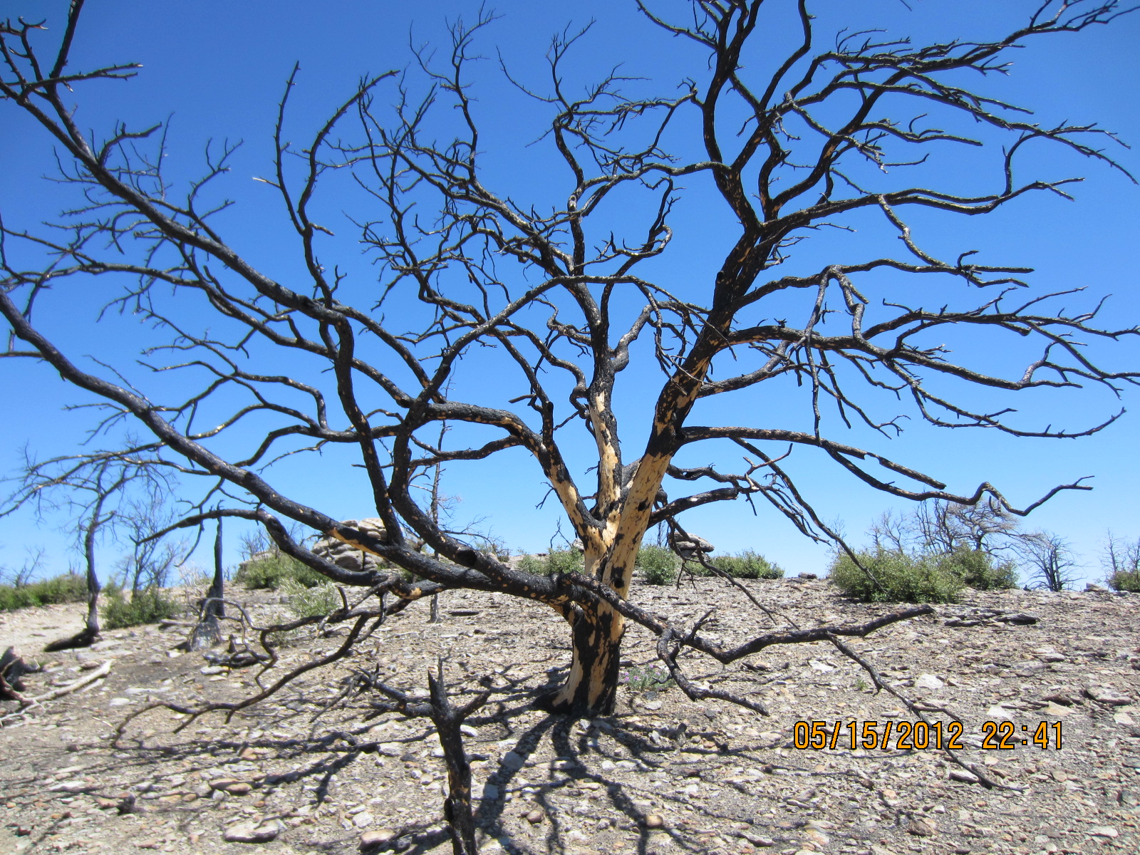
Investigators were unable to access the area immediately and unable to pinpoint the fire’s ignition point because of subsequent fire-fighting activities.It was heartbreaking to walk through burned out areas that were once plush forests. We agreed that we could have endured the pain a little easier if the fires had been from natural causes such as lightning strikes, but knowing they were of human origin made it harder.
 |
I can only imagine how beautiful this tree was before......
|
Jorge made the observation of how you can find beauty everywhere if you look. He then found this burned out tree from the fire and I realized what he meant. This tree - even burned out and barren, was a thing of beauty.
 |
| Sadness at loss of vegetation and wildlife |
We hiked a total of approximately 8 miles. We started at Massai Point and traveled the Mushroom Rock Trail, Big Balanced Rock Trail, Heart of Rocks Loop, Sarah Deming Trail and finally the Lower Rhyolite Canyon Trail back to the visitor center. We had a little welcoming committee waiting when we got back, a group of 3 white tail deer feeding near a campsite. As our group approached they continued to feed on new vegetation, showing no fear of us. Ahhh nature, you got to love it!
 |
| White-tailed fawn having lunch |
More random pics from an excellent hike!!!
 |
| Camel's Head |
 |
| Formations at the Heart of Rocks Loop |
 |
| Kissing Rock |
 |
| Punch & Judy |
BREAK TIME YAY!!!
 |
| Happiness is a PB&J sandwich |
 |
Jorge unloading his gear
|
 |
Ernie always has the best sandwiches!

|
 |
| On the trail again..... |
 |
| These look like sentries guarding the monument |
 |
I named this one Sly and the Family of Stone
Happy Trails to you, until we meet again! |


This looks like it was a nice place to visit. One day I might take the walk with you.
ReplyDeleteI'll hold you to that when it cools off again! There are lots of trails, we don't have to do an 8 mile hike if you don't want to. lol
ReplyDeleteThis looks like it was indeed a whole lot of fun. Nice pics and narrative.
ReplyDeleteThanks Cros!
ReplyDelete